Fleetwood Cemetery, Brown County, Indiana
Revolutionary Grave Marker Dedication
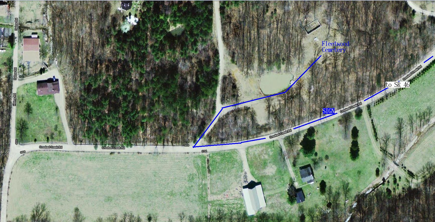
Directions from Bloomington, Indiana, to Fleetwood Cemetery in Brown County
- Start from East Third Street (IN State Road 46 E)
- Go East to SR 446 and continue on SR 46 (measure distances from here) (0.0 mi)
- Pass Belmont and continue East on SR 46 (7.5 mi)
- Pass Knights Trash Removal on North side and continue (9.6 mi)
- Turn South (right) onto Crooked Creek Road (gravel) (10.2 mi)
- Cross one-lane bridge (10.4 mi)
- Crooked Creek Road becomes paved at Yellowwood Forest sign on left (13.4 mi)
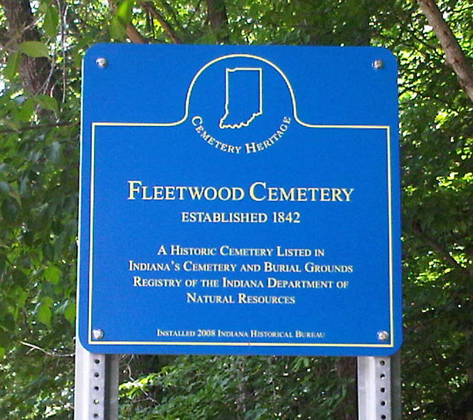
- Pass Fleetwood Cemetery sign (blue historical marker) on right (13.6 mi)
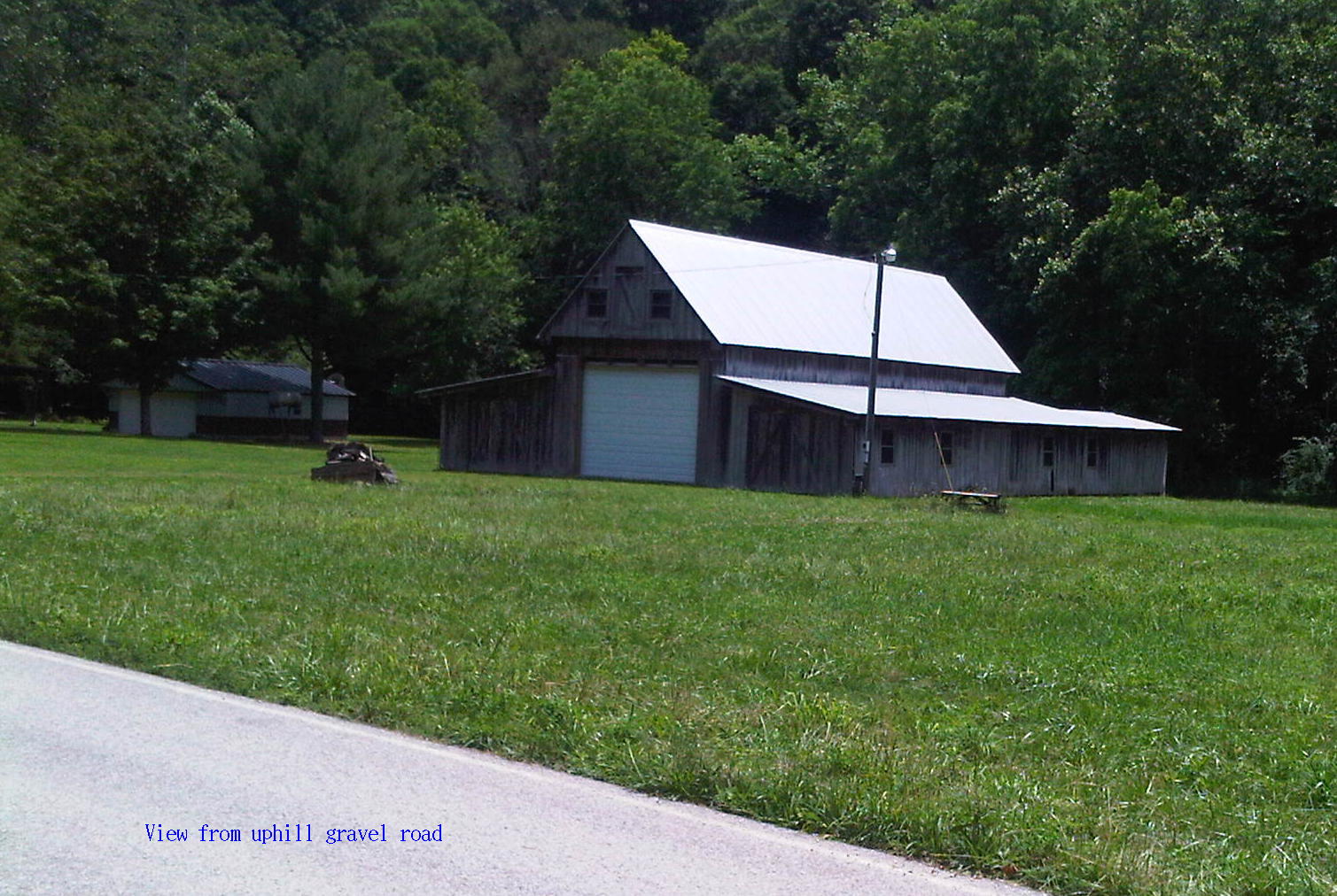
- Pass house and barn on left.
- Turn right 135° onto uphill narrow rough gravel road (13.7 mi)
- Note that Crooked Creek Road meets Helms Road about 0.1 mi after this point; see aerial view.
- The uphill gravel road was badly eroded, but has recently been graded – it becomes smoother and less steep after about 150 feet.
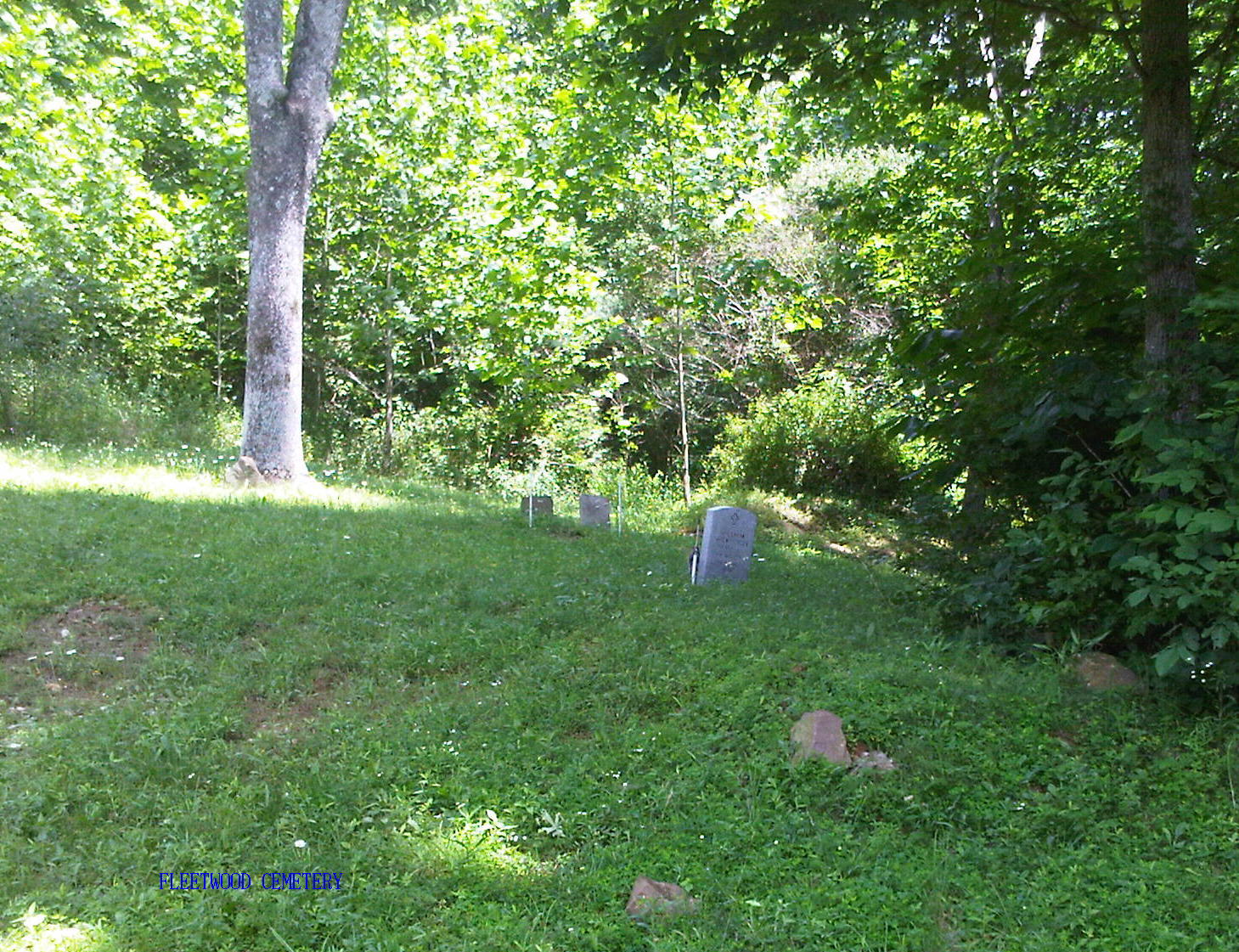
- From Crooked Creek Road, go 50 paces up the gravel road and then go up path on the right 100 paces to foot of cemetery clearing. There is a pond on the left side of the path and a utility pole on the right.
Notes:
- Distances were measured with BB GPS.
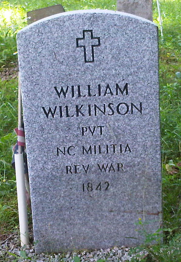
- Location of Fleetwood Cemetery measured at Wilkinson stone is
- Latitude N 39° 9.3976'
- Longitude W 86° 29.3803'
- Altitude 522 ft
Images:
- Fleetwood Cemetery historical sign
- Aerial view of Crooked Creek Road and Fleetwood Cemetery
- View of barn from gravel road leading to cemetery
- View of Fleetwood Cemetery from foot of clearing
- Photo of Wilkinson stone marker